Categories
Activity Essentials

Ordnance Survey Explorer Mobile Maps

Have you ever wished you could get your Ordnance Survey Explorer maps on your phone?  Well now you can.  Ordnance Survey are rereleasing their Explorer series of maps with a free mobile download included in your purchase.

How does it work?

It’s simple, just download the Ordnance Survey OS Maps app for Apple or for Android.

When you buy a map which is marked as “Now includes Mobile Download” on the cover, there will be a unique code inside the map (hidden with silver like a scratch card), type in the code to your app and then you can download the app to your phone.

What can you do with the app?

Obviously one of the most helpful functions of a map on your phone, is that you can be sure of where you are!  The app will show you your current location, you can plan and save a route for later and you can search for places by name.  The maps are saved down to your phone so you don’t need to worry about not having a mobile signal.

Which maps can I buy?

Currently Ordnance Survey have soft launched these new maps by just releasing Britains National Parks and the Areas of Outstanding Natural Beauty, but later in 2015 all explorer maps will be available and in 2016 Landranger too!

Don’t forget the map!

It may be very handy to have an OS map on your phone but at Procamping we never travel without a physical paper map, you just don’t know when your phone is going to run out of batteries!

Shop -

Shop for Maps at the official Ordnance Survey Website (Make sure you look for the blue “includes mobile download on the cover”
Download the app for Apple or for Android.

Categories
Activity Essentials

Ordnance Survey Locate

OS Locate

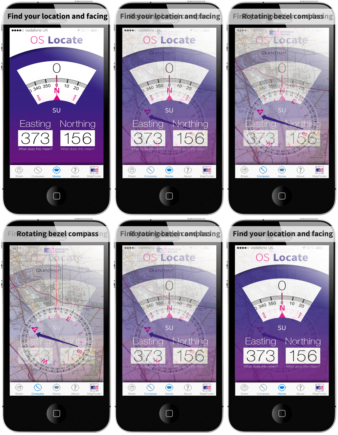
Ordnance Survey have just released a new iPhone App to help you pinpoint your exact location in the United Kingdom.  Whether you are completely lost or on a long trek and just want some reassurance this is a helpful app to show you where you are.

The App uses your GPS location and converts this into OS grid references, so that you can plot your exact position on a paper map.  As it uses GPS it doesn’t need an internet connection to work.

The App also contains a digital compass, and an about section full of tips and tricks to help you navigate.

As always at Procamping we love how technology can be used to assist your adventures, but do not rely on technology alone, too many times we have been out to find our phone battery die mid hike!

The OS Locate app is available for free from the iTunes app store here.

An Android version is coming soon.

Categories
Activity Essentials

Splashmaps

SplashMaps were on show at the Outdoors Show in London but I completely missed them!  I have since read a couple of articles on the Splashmap and thought how could I have missed that!  But I guess however carefully you walk round an exhibition centre you’ll always miss something!  Splashmaps is a great concept, their thought is that traditional maps aren’t designed for the outdoors, a paper map gets dirty, ripped and wet, a plastic coated map is bulky and difficult to carry.

Enter the SplashMap, a fabric map, this makes it lightweight and durable.  The creators are even seen wearing it as a bandana while mountain biking!

The above You Tube clip shows a BBC News feature on Kickstarter a crowdsourced funding site which Splashmaps used to gain enough funding to attend the Outdoors Show and produce a new map.

The Maps

You won’t recognise any of these maps, they are not your traditional 1:25,000 or 1:50,000 maps, they have combined Ordnance Survey data and Open Streetmap data to create a map specalised to the needs of an outdoor adventurer!  This means the scale is actually 1:40 000, a scale that they describe as the sweet spot between having enough detail to know where you are, but being a large enough scale so you can cover a decent distance with just the one map.

Today SplashMaps are just starting out, they have two maps available to purchase directly on their website - The Western South Downs and the New Forest, they plan to continue to expand the range with maps of the National Parks of Great Britain, site-centred maps and maps of other parts of the world!

What do you think?

What do you think?  Would you find a fabric map an essential or do you find a traditional map just fine and see no need to change?  Leave a comment and let everyone know.

Categories
Books & Guides

Make your own Ordnance Survey Map

Ordnance Survey have just released a fantastic new feature on their webstore, they are giving you the ability to make your own custom-made map.  Maps are professionally printed on tough and durable map paper and delivery is free.

Its simple to do -

  • Search for a place or postcode
  • Choose a type of map (Folded for activity or flat to put on the wall)
  • Pick between Explorer (1:25 000) (20x20km) or Landranger (1:50 000) (40x40km)
  • Pick English or Welsh
  • Check that the map covers exactly the area you want, centre and lock the map
  • Give your Map a title, sub-title and an image
  • Add to Basket

This could make a fantastic gift for adventurers, if you want to make a holiday more memorable, or perhaps it is a Honeymoon or Anniversary trip why not make a map!  The price is currently £16.99 and if you order before 2pm maps are dispatched the next working day!

Leave a comment and tell us what location you would pick for a map and what occasion you would buy it for.